Showing posts with label Area: Blue Force Tracking. Show all posts

January 10, 2012

Contract Award: Comtech to support U.S. Army's Movement Tracking System and Blue-Force Tracking programs


News Report

As announced in a recent press release, Comtech Telecommunications received multiple orders totaling $16.6 million to support the U.S. Army's Movement Tracking System ("MTS") and Blue-Force Tracking-1 ("BFT-1") programs. These orders were placed under the auspices of the BFT program office and brought the total orders received to-date under Comtech's $384.0 million BFT-1 contract to $378.2 million.

The first order for $12.0 million included the supply of MT-2012 mobile satellite transceivers to support the MTS program and MT-2011 mobile satellite transceivers to support the BFT-1 program.

The second order was for the continued supply of satellite bandwidth, satellite network operations, engineering services and program management to support the MTS program for the period January 1, 2012 through March 31, 2012.

Pricing for the second order has not yet been finalized with the U.S. Army and related funding cannot exceed $4.0 million. Additional orders aggregating approximately $0.6 million primarily related to engineering services to develop an operational interface between the MTS network and a standard FBCB2 protocol currently being used by the BFT-1 system.

The Technology

The MT-2012 is the newest member of Comtech Mobile Datacom’s packet data network, providing near real-time satellite-enhanced communications services.

MT-2012
The need for increased functionality led to the development of the MT-2012 which integrates GB GRAM (Ground-Based GPS Receiver Application Module) military GPS and radio frequency identification (RFID) technology with their own specific antennas within a rugged metal housing designed to withstand the rigors of the battlefield environment. An RFID interrogator provides Total Asset Visibility (TAV) by interrogating RF tags attached to cargo containers and reporting data back to headquarters over the satellite link. The addition of a 512K buffer allows the MT-2012 to accept large data dumps for packetized transmission over the satellite. The MT-2012 joins the MT-2011 as the solution of choice for over-the-horizon, on-the-move (OTH/OTM) missions under battlefield conditions, operating anywhere in the world over commercial satellite systems to track mobile assets and provide two-way communications.

The United States Army’s Movement Tracking System (MTS) provides two-way text messaging and position reporting between mobile and fixed assets.

MTS Movement Tracking System


MTS can operate anywhere in the world giving over-the-horizon communications to vehicles on the move. Messages are transmitted via commercial satellites in near real-time, and vehicle locations are displayed on computers with NGA maps. All messages are encrypted end-to-end, including sender and recipient addresses for information security purposes. MTS operates over a variety of geostationary satellites and is designed to transition automatically from one satellite system to another, as required.

Comtech Mobile Datacom Corporation was awarded the MTS contract in 1999. Comtech has designed a spread-spectrum, packet-switched data network that uses state-of-the-art modulation techniques and short burst transmissions. This provides low probability of intercept/detect characteristics to reduce the likelihood that hostile forces can determine the sender’s position or intercept other intelligence. To meet changing mission requirements, Comtech Mobile Datacom developed an enhanced Movement Tracking System (MTS) designated the MTS Plus. The MTS Plus provides In-Transit Visibility (ITV) of units deployed in the battlefield as well as visibility of units providing tactical and logistics support. The MTS Plus also incorporates additional safety features and durability improvements.

Comments

Fred Kornberg, President and Chief Executive Officer of Comtech Telecommunications Corp., said, "We are pleased to receive these orders which provide for the uninterrupted delivery of MTS services to the U.S. Army and which continues our long standing support of the MTS and BFT-1 programs. We also believe the receipt of additional hardware orders demonstrates the ongoing importance of the U.S. Army's BFT-1 and MTS satellite tracking communication systems which currently support deployed U.S. forces worldwide."

References: Comtech (1,2,3)

Thales' GeoMux SDR waveform provides simultaneous Voice, Data and Blue Force Tracking


News Report

As illustrated in a recent press release, Thales has launched a a new VHF waveform, named GeoMux, which provides simultaneously three main services - Voice, Data and Blue Force Tracking - answering perfectly the interoperability requirement of modern Battlefield Management Systems (BMS). The new GeoMux waveform will become part of Thales’ PR4G F@STNET - Combat Net Radio. Specifically, GeoMux waveform will equip all PR4G F@stnet radio models, i.e. handheld, manpack and vehicle stations.

The Technology

GeoMux is an advanced Electronic Protective Measure (EPM) VHF waveformwhich includes a unique transverse communication capability allowing the radio to operate simultaneously on two independent radio channels. The first channel is used for normal voice and data traffic while the second channel is used to exchange geographical data.

With network centric operation, the need for information increases significantly. Today, it has become essential to efficiently interconnect the various actors in military operations at all levels, from national Joint Headquarters down to soldiers in remote areas. Seamless interoperability is the key word, enabling cooperative operations with allied forces over legacy and future networks. Supporting these new capabilities and offering simultaneous Voice, Data and Blue Force Tracking, GeoMux meets all user operational requirements in a single radio equipment.

Comments

With this new waveform in its software library, Thales once again demonstrates its innovation capacity and its skill in software defined radio technologies” said Patrice Caine, Vice President of Thales in charge of radio communications activities.

References: Thales (1,2)

December 15, 2011

U.S. Army completes key operational tests of General Dynamics' Rifleman Radio


News Report

We have already highlighted the importance of U.S. Army's Network Integration Evaluations (NIEs) as an effective process to integrate and mature the U.S. Army’s tactical network, as well as to evaluate deliberate and rapid acquisition solutions (NIE has been selected as one of the key C4I trends of the last months).

In such context, we report a recent press release from General Dynamics which announces that the JTRS HMS AN/PRC-154 Rifleman radio completed its Initial Operational Test and Evaluation during the U.S. Army’s recently concluded NIE 12.1 at Fort Bliss, Texas. Members of the 2nd Brigade, 1st Armored Division (2/1 AD) evaluated the AN/PRC-154 Rifleman radio in a variety of tactical exercises that included convoy operations, reconnaissance, counterinsurgency and medical evacuation missions.

The Rifleman radio, one of the Joint Tactical Radio System (JTRS) Handheld, Manpack, Small Form Fit (HMS) family of radios, is the first JTRS radio to use the Soldier Radio Waveform (SRW) to enable secure networked communications among platoon, squad and team-level soldiers and their leaders. The Initial Operational Test and Evaluation is the last formal test required by the military before the radios enter full-rate production.

During the NIE exercise, soldiers used the radios in conjunction with handheld devices running Joint Battle Command-Platform software, i.e. the future version of the U.S. Army's friendly force tracking and messaging system, which also allows users to plot hazards and enemy locations on a digital map. Plugged into the Rifleman Radio, these devices provided mission command and situational awareness information down to soldiers at the tactical edge.

During the test, the Army captured data on the radio's performance in two ways: through instrumentation on the systems themselves, and through human data collectors who accompanied soldiers throughout their missions. U.S. Army will evaluate those test results during the coming months, as it finalizes the makeup of its network Capability Set 13, which will begin fielding to up to eight brigade combat teams in fiscal year 2013.

The System

General Dynamics' Rifleman Radio delivers networking connectivity to the frontline soldier in a lightweight, ruggedized, body worn device. The radio transmits voice and data simultaneously utilizing the Soldier Radio Waveform (SRW), which operates in the 1.755-1.850 GHZ frequency range and supports digital 16 KBPS voice and data at 1 MBPS.

SRW represents a networking waveform capable to perform in a complex military environment, in the presence of adversarial threats, and providing a secure high-bandwidth communications link specifically designed for platforms that are small, light, don’t consume much power and use low-profile antennas.

The AN/PRC-154 is body worn, minimizing the warfighter’s combat load while increasing functionality. Designed to bring secure (Type 2) inter-squad communications to any warfighter on the tactical edge of the battlefield, this radio also enables Team and Squad Leaders to track individual soldier GPS locations. This radio connects every warfighter to the combat network, emphasizing safety and enabling enhanced situational awareness and better decisions at the very edge of the battlefield.

The software-programmable AN/PRC-154 radios, which can use encryption to safeguard information, are built to send Internet Protocol packets of data, voice, video and images via multiple waveforms between static command centers, vehicles on the move, and dismounted individual soldiers on patrol. The JTRS waveforms, SRW and the Wideband Networking Waveform, known as WNW, are integrated with the satellite communications backbone of the Army network, Warfighter Information Network-Tactical, or WIN-T, to transmit that information on the upper tactical internet.

The Context

The Rifleman Radio is part of the JTRS Handheld, Manpack, Small Form Fit, or simply JTRS HMS, family of radios.

JTRS HMS is a materiel solution meeting the requirements to support U.S. Special Operations Command, U.S. Army, U.S. Marine Corps, U.S. Air Force, and U.S. Navy communication needs.

In June 2011, the JTRS HMS program achieved a Milestone C decision, enabling the Low Rate Initial Production of 6,250 AN/PRC-154 Rifleman and 100 AN/PRC-155 Manpack radios. JTRS HMS radios take full advantage of the government’s library of waveforms, including the Soldier Radio Waveform, and in the future, the Mobile User Objective System (MUOS) and Wideband Networking Waveform (WNW) critical to communicating on the U.S. Army’s emerging tactical communications network.

The Embedded Small Form Fit versions of HMS will be used for Joint Service Ground Sensor Networks, Intelligent Munitions deployment and usage, Unmanned Vehicles and other platform applications, including support for the Early-Infantry Brigade Combat Team technical performance and integration.

General Dynamics C4 Systems is prime contractor for the JTRS HMS program. The JTRS HMS team includes BAE Systems, Rockwell Collins, and Thales Communications.

The results of the tests on the Rifleman Radio should now dissolve the questions of a possible affect of the JTRS GMR program termination on the JTRS HMS program. As already discussed, large cost overruns and numerous schedule delays forced the U.S. Army to cancel the JTRS Ground Mobile Radio system. The GMR program has been terminated on last October in line with the Nunn-McCurdy statute, which calls for a program's termination once unit-procurement costs exceed the original estimate by 25 percent unless it is deemed essential to national security.

Comments

We’re getting great feedback from soldiers who prefer the Rifleman radio, rather than lugging bulky wideband handheld radios that require extra batteries,” said Chris Brady, vice president of Assured Communications for General Dynamics C4 Systems. “With the Rifleman Radio, soldiers can connect their cell phone or computer and join the network—anywhere they fight.

"I use it for overall command and control because it builds a network that allows me to talk to my subordinate elements," said Capt. Ryan McNally, company commander with the 2/1 AD. "It's the first time I've actually had radios down at the squad level. So my dismounted riflemen, they all have the radio as well. It allows them to talk to their team leaders when they're spread out, and also allows them to talk to the squad leader."

"No matter what kind of organization you're running, if you have dismounts who are going to be on the ground you like to be able to see where your personnel are," said 2nd Lt. Travis V. Mount, 2/1 AD platoon leader, speaking about the capability of the Rifleman Radio to show the positions of his troops, which allowed him to save time by immediately adapting and executing his plans rather than tracking down personnel first. "If all I need is information on their position, I don't have to go through an intermediary. I can on the spot adapt my plan."

"Instead of having to go to the tactical operations center at the end of the day to download the information on the events and observations, I can either (do it in) real time or when I have a lull in the mission," Mount said. "I can just plug it in right there."

Further Readings
  • Joint Tactical Radio System HMS (pdf)

References: General Dynamics (1,2), JITC (3), Defense Systems (4), DVIDS (5), JPEOJTRS(6)

November 30, 2011

Project Review: the Afghan Mission Network


All ISAF forces (~100,000 additional users) must move to a common network to more effectively share information and resources across Afghanistan
(General Stanley McChrystal, USA, COMISAF)
History

ISAF (International Security Assistance Force) was created in accordance with the Bonn Conference in December 2001. Afghan opposition leaders attending the conference began the process of reconstructing their country by setting up a new government structure, namely the Afghan Transitional Authority. The concept of a UN-mandated international force to assist the newly established Afghan Transitional Authority was also launched at this occasion to create a secure environment in and around Kabul and support the reconstruction of Afghanistan.

On 11 August 2003 NATO assumed leadership of the ISAF operation, ending the six-month national rotations. The Alliance became responsible for the command, coordination and planning of the force, including the provision of a force commander and headquarters on the ground in Afghanistan.

For the majority of organizations operating in Afghanistan, the problem was not data scarcity. This was particularly evident after the first years of operations and interaction with military units, local and national leaders, regional and global media, fact-finding teams, governmental and non-governmental survey organizations, and an alphabet soup of other international actors. Rather than scarcity of data, it was both data overload and the “glare” of ambiguous, contradictory, inconsistent, latent, and incomplete reporting that often caused ISAF forces to avert their eyes and diffuse their attention from the underlying dynamics and relationships of key actors and drivers that really matter in the Afghan operating environment.

Already in 2006 the U.S. and NATO embarked on an effort to establish mail exchange between the NATO and U.S. mission networks. The U.S. mission network at the time was the Combined Enterprise Regional Information Exchange System (called CENTRIXS) Global Counter Task Force (GCTF) and NATO operations were conducted on ISAF SECRET. This project sought to enable email exchange between the two networks. Although the objective was achieved (mail was exchanged), the solution included various guards, firewalls and intrusion detection systems that made it difficult to use and administer. It was so difficult that the system failed for 35 days without even being reported.

The next notable effort in NATO-national interoperability in Afghanistan was the UK-led effort, OVERTASK. With the UK forces deployed to Regional Command South and Helmand in 2005, there was a requirement for UK forces to be interoperable with coalition partners. The solution to meet this requirement was OVERTASK which was based on an enclave within the NATO mission network, ISAF SECRET. A portion of the ISAF SECRET was dedicated for the use of UK forces. As the UK operated on the same network as NATO forces, interoperability was assured. However, operating on the same network requires centralised configuration control. This centralised control maked it difficult for individual nations to install and operate their own nationally-developed systems without considerable coordination.

The real genesis of the Afghan Mission Network can be traced back to 2008, when the Afghanistan campaign plan was revised and the U.S. brass began to look for a way to develop a true mission network for Afghanistan. At that point the U.S. was mainly operating on SIPRnet and NIPRnet, while NATO and the coalition members were on the ISAF secret network. NATO funded an effort to provide voice, chat and Web access over a United Kingdom network called Overtask. But there was still not a real capability for the U.S. to communicate with coalition members at the secret level.

In order to increase situational awareness, Gen. Stanley McChrystal, commander of the ISAF and U.S. Forces Afghanistan, required each coalition nation to share information on a single information infrastructure, the Afghanistan Mission Network. On 7 April 2010, NATO’s resource committees formally approved the way ahead for the Afghan Mission Network project, which radically changed the way Nations contributing to the ISAF mission share information.

The Afghan Mission Network basically provided the connective tissue between the U.S. CENTRIXS (Combined Enterprise Regional Information Exchange System), which is the theater version of SIPRNet, and NATO’s ISAF Secret network, to which the networks of the other ISAF nations connect. By law, SIPRnet does not allow access to non-U.S. users.

Initial operating capability for the network was declared in July 2010, signifying the availability of the network to at least 50 percent of all ISAF forces. AMN’s initial capabilities facilitated human-to-human contact that includes chat, VoIP telephone connectivity, e-mail, Web browsing, friendly force tracking exchange and video teleconferencing.

Analysis

Tipycally, Coalition forces do not easily share information, and Commanders had to gather at a central location to discuss plans without the use of advanced technology. Often, one of their only viable alternatives is to share mission-related information via "Sneaker net". This cumbersome practice called for the warfighter to transfer information onto removable media and manually move it from one system to another, which often is not secure, is very labor intensive, and prohibits information from being shared in a timely manner.

The Afghan Mission Network marks a strategic shift in the sharing of data.

U.S. Defense leaders and their counterparts from other nations say a network infrastructure linking coalition partners in Afghanistan has fundamentally changed the way the multinational effort has been conducted over the last several years. NATO, the U.S. military and other national forces say the Afghan Mission Network (AMN) as it now exists has been a game changer for operations in Afghanistan. Earlier efforts didn't work so well. As already stated, one progenitor to the AMN, geared toward bridging simple email capabilities between U.S. and NATO, was so cumbersome and hard to use that it went out of service for more than a month and no one noticed.

From their respective secure networks, and at their individual discretion, separate Coalition forces can share data, situational awareness and Commander’s intent across the battlefield on a centralized network.

AMN is also an example of technology that allows expeditionary forces to move their data as they deploy. Divisions install the AMN in their headquarters, which allow them to virtually move data when they deploy. This keep the units from having to physically move their servers and there is in principle no lag in the data because it is constantly being updated.

Nowaday, the success of the AMN is spreading beyond the ISAF coalition. Civilian partners in Non-Governmental Organisations (NGOs) have expressed interest in being able to share information with the AMN.

AMN in brief

The Afghanistan Mission Network AMN is the primary Coalition C4ISR network in Afghanistan for all ISAF forces and operations consisting of the ISAF-Secret network as the core with national extensions.

The Afghan National Army furnishes the infrastructure to enable the U.S. and other Coalition forces to provide them with relevant, though selective, data and situational awareness, which does not compromise the security of any partner including the U.S. The Afghan National Army can then respond, making crucial decisions based on current and comprehensive data.

As already stated, the ISAF Secret Network provided by the NATO NC3A is the heart of the AMN. It is connected via six network interconnection points to CENTRIXS and to the networks contributed by Italy, the United Kingdom and Canada. “If Italy wants to talk to us, they can transition across the ISAF core from their network and talk to us over CENTRIXS,” said Lieutenant Colonel Andy McClelland, who is attached to NATO Allied Command Transformation headquarters in Norfolk. “The core is the glue the binds all of the networks together.

The AMN allows nations to operate their own network within the ISAF SECRET classification, which seamlessly connects to the ISAF SECRET core through a series of Network Interconnect Points (NIPs).

AMN enables the 45 nations of the Coalition to unite and fight the enemy as a single force, leveraging the combined strength of each partner.

Red, Blue, Green, White

Different national networks use different viewers to examine data, i.e. the Canadians use a system called BattleView, the U.S. uses Command Post of the Future and the British have a system called JADOCS. The firts task of AMN was to make data available to all these viewers. “Data is published on a server,” said U.S. Army Colonel Pete Gallagher, chief of the ISAF CJ6 branch, at ISAF headquarters in Kabul, Afghanistan, “and users subscribe to that data.

But while the common perception is that battlefield systems provide information about friendly and enemy forces - so called blue and red forces - in Afghanistan, it may be the green and white icons on the screen that make the real difference. Green is the color for the Afghanistan government and security forces, while white represents the local population centers. “We’re trying to separate the red and the white, the insurgents from the population, and insert the green between them, which is the Afghan government and the security forces,” said Col. Derek Orndorff, USA, the communications director for the ISAF Joint Command in Kabul, Afghanistan. “That information is not in the normal, everyday battle command systems that we just pull off the shelf. This is all stuff that is created from the bottom up, from the guys who are on patrol walking around in the bazaars, who had a key leader engagement with an elder in a village. That information has to get into the system in ways that we’ve never done it before. We’ve been getting after that here in Afghanistan.

One way of providing access to that information has been to add a wiki capability to the AMN that allows tip-of-the-spear forces to share vital human intelligence at all levels. By clicking on a particular city or region, for example, a commander can research local leaders, based on impressions and information provided by personnel who have had first-hand encounters.

Cyber Issues

The Conficker computer virus, which was first detected in 2008, reared its ugly head on April 2011 in Afghanistan, where it was detected on the Afghan Mission Network.

We had an older virus that showed up on the network, and when that older virus was discovered, we immediately isolated it, protected the rest of the network, identified what we needed to do, and in about five hours, everybody was operating normally again,” says Col. Derek Orndorff. “It was the Conficker worm. It was a success story from our perspective because our tools picked it up, we identified it, we protected the entire network, and we were able to defeat the challenge relatively quickly and get back to business instead of letting it become debilitating to us.

Col. Orndorff credited network transparency for helping to quickly stamp out Conficker. “AFN is a very open and flat network, so if a user on an ISAF machine wants to see something on the United Kingdom OVERTASK, there’s no login, no firewalls, no certificates, no passwords. There’s nothing. What that means is that everyone who is part of the network has a shared vulnerability. Everybody shares the same risks. So therefore, when we have challenges, we have to have transparency between all the different parts and pieces or you’re going have problems with it,” he explained. Without that transparency, CENTRIXS network operators could have chosen to remain mum about the Conficker vulnerability, which would have allowed it to spread. “This incident was a perfect example of why this is so successful, because everybody understands where their piece is in this so we can all work together.

Comments

On the battlefields of Afghanistan, AMN has transformed the way Coalition Commanders share information,” said Brig. Gen. N. Lee S. Price, PEO for C3T. “Independent discussions and planning efforts between separate Commanders of different nations have been replaced by data sharing across AMN.

References: DefenseSystems.com (1,2,6,10), NATO (3,4), CimicWeb (5), AFCEA (7,11), Military Information Technology (8), KZO Innovations (9)

November 28, 2011

U.S. Army concludes the NIE 12.1


News Report

Here in this blog we have extensively covered the recent exercises that have been scheduled by U.S. Army within the Network Integration Evaluation process (NIE). Establishing the NIE helped the U.S. Army employ a new agile acquisition process, since the U.S. Army now has a strategy to keep pace with industry and technological network advances and accelerate the pace of network modernization to a rate unachievable by traditional acquisition strategies.

As reported by the U.S. Army, the second Network Integration Evaluation, or NIE 12.1, has now concluded. The three-week event, represented the first time that all of the components of the U.S. Army network to be fielded in fiscal year 2013 were united and evaluated in a realistic operational environment. Soldiers at the lowest echelons were brought into the network, communicating through text messages, digital photos and chat rooms. Company commanders made quick decisions using information received in real time while moving around the battlefield. New hardware and software was integrated for the first time outside of a lab, and put to the test in mountainous desert terrain that mirrors the communications challenges in rugged places such as Afghanistan.

The second in a series of semi-annual field exercises designed to rapidly integrate and mature the U.S. Army's tactical network, NIE 12.1 involved 3,800 Soldiers of the 2nd Brigade, 1st Armored Division evaluating dozens of systems in operational scenarios. Soldier feedback and test results from the NIEs are directly shaping the makeup of the U.S. Army's network Capability Set 13, which will begin fielding to up to eight brigade combat teams in fiscal year 2013. Additional brigades will receive the latest network assets as part of Capability Set 14. Those capability sets will include greater bandwidth to transmit voice, video and data across the battlefield, as well as the ability to bring situational awareness and mission command information down to the dismounted Soldier.

NIE 12.1 provided the means to test, evaluate, and conduct risk reduction on a number of systems. One of those systems is the Warfighter Information Network-Tactical (WIN-T) Increment 2, i.e. the U.S. Army’s on-the-move, high-speed, high-capacity backbone communications network, linking Warfighters on the battlefield with the Global Information Grid (GIG). WIN-T introduces a mobile, ad-hoc, self-configuring, self-healing network using satellite on-the-move capabilities, robust network management, and high-bandwidth radio systems to keep mobile forces connected, communicating, and synchronized.

NIE 12.1 was also host to the Joint Tactical Radio System, or JTRS, Rifleman Radio program of record test. This radio, which is carried by platoon, squad and team-level Soldiers for voice communications, can connect with handheld devices to transmit text messages, GPS locations and other data. Soldiers with 2/1 AD also informally evaluated more than 45 other systems, including solutions proposed by industry to meet the Army's identified network capability gaps.

The Context

The NIE process was born of the U.S. Army’s recognition that its requirements, testing and acquisition processes were too slow, expensive and complicated. Moreover, it did not include the operator’s perspective. This realization was in itself a minor miracle. Credit for this epiphany goes to the outgoing Vice Chief of Staff, General Peter Chiarelli.

The U.S. Army is including the individual soldier in the NIE process. The solutions are not being imposed on them by a program office or acquisition authority. The soldiers in the field are telling the evaluators what works and what does not, what else they want and how they want to employ these new capabilities.

The next event, known as NIE 12.2, will take place in the spring and further solidify the Capability Set 13 network. The six-week event will include the formal operational test for the Warfighter Information Network-Tactical, known as WIN-T, Increment 2, the Army's on-the-move, satellite-based communications network, which was informally evaluated at NIE 12.1.

Comments

"We are getting a great look at connecting the Soldier to the network, and a fantastic look at mission command on the move -- for the first time in an operational setting," said Col. John Morrison, director of the Army G-3/5/7 LandWarNet-Battle Command Directorate. "For the first time we've got everything talking together, so now we can establish an integrated network baseline. It's just been phenomenal."

"Getting information technology to the field in a rapid fashion is what we're trying to do here," said Col. Dan Hughes, the Army's system of systems integration director. "Some of the systems that are here are systems that industry paid their money for, that they built, that they brought out, and are in the hands of Soldiers probably five to six years before they would be in the hands of Soldiers if we had gone through the regular (process). And they're getting feedback immediately."

"You can look back in history and think about how we commanded on the move," said  Brig. Gen. Randal A. Dragon, commanding general for the Brigade Modernization Command. "At one time we used messengers or runners. We've used flags while we were moving formations. We've used radios to be able to talk to one another. In this digital age, we're now able to pass information rapidly -- large quantities of information to create a common picture so that commanders can command effectively and get their Soldiers to the right place at the right time."

"It goes back to the basics of what we all do -- shoot, move and communicate," said Sgt. Ryan Moore. "All this equipment lets us do that faster. There's no shooting flares in the air to signal things anymore. I can call somebody, and everybody knows; we're all on the same page at the same time."

References: U.S. Army (1), Military.com (2), Defensemedianetwork (3), DefPro.com (4)

November 4, 2011

Network Integration Evaluation 12.1


News Report

Here in this blog we've already discussed about the benefit that U.S. Army is receiving through the Network Integration Evaluation (NIE) exercises (1,2), i.e. a serie of semi-annual evaluations designed to integrate and mature the U.S. Army’s tactical network.

In July 2011 the US Army concluded the first NIE. The evaluation was a six-week effort conducted at White Sands Missile Range, N.M., involving the 2nd Brigade Combat Team, 1st Armored Division (2/1 AD). Its primary purpose was to conduct formal tests of 6 Army Programs of Record, with a secondary purpose to less formally evaluate 29 developmental and emerging networked and non-networked capabilities. The July exercise was the first of this type of combined test and evaluation – a new process that demonstrated the U.S. Army’s holistic focus to integrate network components simultaneously in one operational venue.

Doctrinal results from the July 2011 NIE have shown two broad network findings for Capability Set 13: the U.S. Army lacks Soldier-level connectivity and unit mission command capabilities, and must develop comprehensive requirements accordingly.
The second event in that series, known as NIE 12.1, officially began on Oct. 31. A triad consisting of the U.S. Brigade Modernization Command, U.S. Army Test and Evaluation Command and U.S. System of Systems Integration Directorate will integrate and assess a host of capabilities and determine their implications across doctrine, organization, training, materiel, leadership, personnel and facilities, (known as DOTMLPF). During NIE 12.1, more than 3,800 Soldiers will operate the systems and employ them in various realistic combat scenarios in operationally relevant terrain designed to replicate the environment in Afghanistan.

The U.S. Army has three overarching priorities for NIE 12.1:
  • Bringing lower-echelon Soldiers into the network
  • Executing mission command while on the move
  • Establishing an integrated baseline for the objective and bridge U.S. Army network architectures.
For the first time in an operational setting, Soldiers will attempt mission command on the move using WIN-T Increment 2. WIN-T Increment 2 is a major upgrade to the tactical network backbone that will extend satellite communications to the company level, allowing Soldiers to communicate seamlessly through voice, data, images and video -- even in complex terrain that can break line-of-sight radio connections.
 
While WIN-T Increment 2's formal operational test will take place during NIE 12.2 in the spring of 2012, the U.S. Army's Program Executive Office Command, Control and Communications-Tactical, known as PEO C3T, has installed WIN-T Increment 2 equipment on more than a dozen 2/1 AD vehicles for NIE 12.1, some of which also contain an initial set of mission command software applications. Hosted on a single computing system, the applications will provide mobile company Soldiers with the real-time information that typically would only be available inside a tactical operations center.

These capabilities include Command Post of the Future, or CPOF, a collaborative system allowing users to visualize the common operating picture and efficiently plan the battle; Tactical Ground Reporting, known as TIGR, which empowers Soldiers to collect, share and analyze patrol data in a central database; the Effects Management Tool, which provides access to critical fire support information; and the Microsoft Office Environment, which enables interaction with email and documents from the command post.

These applications will run alongside the next-generation software for Force XXI Battle Command Brigade and Below, or FBCB2/Blue Force Tracking, which is the only major mission command application available on-the-move in theater today.
Soldiers will informally evaluate more than 45 other systems, including solutions proposed by industry to meet the U.S. Army's identified network-capability gaps.
 
Soldier feedback and test results from the NIEs are directly shaping the makeup of the U.S. Army's network Capability Set 13, which will begin fielding to eight brigade combat teams in fiscal year 2013. Ten additional brigades will receive the latest network assets as part of Capability Set 14. Those capability sets will include much greater bandwidth to transmit voice, video and data across the battlefield, as well as bring situational awareness and mission command information down to the dismounted Soldier.
 
The Technology (WIN-T Increment 2)
 
Warfighter Information Network-Tactical (WIN-T) was designed to be the cornerstone tactical communications system supporting the implementation of the U.S. LandWarNet strategy during the 2007 to 2025 timeframe (look here for additional information)
 
WIN-T is the U.S. Army’s on-the-move, high-speed, high-capacity backbone communications network, linking Warfighters on the battlefield with the Global Information Grid (GIG). WIN-T introduces a mobile, ad-hoc, self-configuring, self-healing network using satellite on-the-move capabilities, robust network management, and high-bandwidth radio systems to keep mobile forces connected, communicating, and synchronized

WIN-T Increment 2 adds Warfighter mobility and provides a communication network down to the Company level. Increment 2 enables mobile battle command from Division to Company in a completely ad-hoc, self-forming network. The WIN-T Increment 2 addition of embedding communications gear in the Commander’s vehicles enables SIPR (Secure Internet Protocol Router) into the Warfighting platform. Commanders and select staff have the ability to maneuver anywhere on the battlefield and maintain connectivity to the network.
 
The Technology (Command Post of the Future)
 
The Command Post of the Future (CPOF) is an executive level decision support system providing situational awareness and collaborative tools to support decision making (look here for additional information). Originally a DARPA technology demonstration, in 2006 CPOF became an U.S. Army Program of Record.
 
The CPOF software is based on the CoMotion platform, a proprietary commercial framework for building collaborative information visualization systems and domain-independent "decision communities". CoMotion's design principles originated as a research program at Carnegie Mellon University, and was subsequently developed at MAYA Viz Ltd and General Dynamics C4 Systems.
 
The Technology (Effects Management Tool)
 
Raytheon's Effects Management Tools provide a fires and effects command and control tool to remote users of the Advanced Field Artillery Tactical Data System (AFATDS). 
  • Initial proven capabilities include:
  • Display AFATDS derived fire support situational awareness on the Joint Mapping Tool Kit (JMTK)
  • Initiate a call for fire from the EMT
  • Allow movement of AFATDS maintained units from the JMTK
  • Import and export target lists, air support lists, and geometry worksheets
The Technology (FBCB2/Blue Force Tracking)
 
FBCB2/Blue Force Tracking (BFT) is a digital, battle command information system intended to provide commanders, leaders, and soldiers with integrated, on-the-move, near real-time battle command information and situational awareness from brigade to vehicle level. Three principal components are the hardware, software, and either a Tactical Internet (Terrestrial FBCB2) or L-band
satellite (Blue Force Tracker) communications means. FBCB2 provides a capability for developing and distributing orders, friendly locations, operational graphics, combat reports, and free text messages.
 
The FBCB2 system provides software and hardware tools that supporting battle command and near-real-time brigade level situational pictures, down to the individual soldier, single platform level. The system integrates over 1,000 subscriber sets covering the brigade's entire area of interest, including Bradley or Stryker combat vehicles, M-1A2 tanks, AH-64D, OH-58D and Black Hawk helicopters, artillery and combat support elements etc.
 
Comments on NIE 12.1
 
"It's a revolutionary thing to push the network all the way down, because it allows a more real-time interchange of information and a much more proactive force," said Capt. Joseph D. Perry. "You provide the data up, it's analyzed, and they can turn around and say, 'Hey, this number matches this number,' push it right back down to the patrol and say, 'We need you to go hit this place now."
"Our mission is to integrate network capabilities into a real-world scenario, and evaluate how the networked capabilities interface with each other and how we can employ that effectively on the battlefield," explained Capt. Patrick Lavin, 2/1 AD Brigade battle captain.
 
"We can shorten the cycle time of acquisition, which equals cost savings, and gets capabilities to the hands of our Warfighters a lot quicker," said Heidi Shyu, the acting assistant secretary of the U.S. Army for Acquisition, Logistics and Technology. "Leveraging these types of exercises also allows us to understand and resolve interoperability issues before we deliver this equipment downrange."
 
"The network is nothing more than an enabler," said Col. John Morrison, director of the Army G-3/5/7 LandWarNet-Battle Command Directorate. "The key is mission command essential capabilities that we want to deliver for our leaders and our Soldiers. That is what we're really after. It's about achieving an operational effect."

The Context (NIE)

Establishing the NIE helped the U.S. Army employ a new agile acquisition process; the U.S. Army now has a strategy to keep pace with industry and technological network advances and accelerate the pace of network modernization to a rate unachievable by traditional acquisition strategies. The NIE also has enabled an Army ability to integrate network hardware and software up front before deployment - this will lessen the integration challenges faced by deployed units.

NIE represents thus for the U.S. Army a new way of doing business – a fundamental change in how capabilities are delevered to the Soldiers. The US Army has in fact adopted a strategy that will align the tactical network to the Army Force Generation process (ARFORGEN) through Capability Sets that will enhance vertical and horizontal connectivity and provide an integrated network baseline from the static tactical Operations Center (TOC) to the dismounted Soldier. Network Integration Evaluations are key enablers to executing this strategy.

References: C4I Technology News (1,2), ASDNews (3), U.S. Army (4), Fort Hood Sentinel (5), GD (6), GlobalSecurity.org (7), Raytheon (8), DefenseUpdate (9), Dote.Osd.Mil (10)

October 12, 2011

ITT's RO-MAP software application for dismounted soldiers

References: ITT (1,2,3), public intelligence (4), defense industry daily (5)

News Report

As reported in a recent press release, ITT announced the introduction of its new RO-Mobile Awareness Platform (RO-MAP) that delivers advanced situational awareness and text messaging capabilities. The RO-MAP is a software application that is designed to operate on a rugged PDA, smartphone or personal computer.

The product

RO-MAP integrates regional position location information, text messaging and radio remote control into a single application. Designed as a general purpose dismounted warfighter situational awareness tool.

When connected to the satellite based tactical radios, RO-MAP allows users within 100-250 miles to have a common operating picture (COP) similar to the command center. RO-MAP automatically receives the position location information from other beyond line of sight on-the-move users. The position location information is then placed on a zoomable satellite image Each position location mark can be selected for additional information such as: call sign, latitude, longitude, grid position, altitude, climb, speed and bearing.

RO-MAP can also be used as a remote control device for the RO Tactical Radio. All commonly used functions of the radio can be controlled and monitored including speaker volume and networks assigned.
The Context

The first application of the RO-MAP is for use with the Distributed Tactical Communications System (DTCS), an experimental, satellite-based, communications system that incorporates Iridium satellite technology, software, and commercial GPS. DTCS provides on-the move, beyond line of sight communications for dismounted users. The program was developed by US Government to enable US Marines deployed inland to communicate back to their ships.

DTCS's Phase 3, launched in 2011, begins to include “theater-wide” or Global Reach nets, and make infrastructure improvements that allow greater efficiency, higher capacity and improved quality of service.

Iridium itself sees Phase 3 as a strategic investment phase, now that more limited proofs of concept have become an important part of the tactical communications toolkit.

Comments

RO-MAP provides integrated mobile awareness to assist warfighters in friendly force tracking,” said Mark Adams, vice president of ITT Commercial Wireless Systems. “This new technology is part of ITT’s continued innovation that delivers communications solutions and advantages to U.S. forces and allies on the battlefield.

October 7, 2011

NATO Bold Quest Exercise 2011

References: NATO (1), National Guard (2), Rumor Mill News (3), Army Times (4), dvids (5)

News Report

Some interesting comments on NATO Bold Quest 2011 Exercise were published recently on NATO ACT news archive and other news sources. The exercise was hosted at Currently, Atterbury-Muscatatuck Complex, in Central Indiana, between Sept. 8th and Sept. 23rd. Here, 12 NATO member nations were involved in a joint staff combat assessment exercise designed to test the interoperability of target identification systems to reduce friendly fire incidents.

The exercise was aimed to test technologies driven by the need to provide tools to make warfighters more effective in engaging targets while minimizing the risk of fratricide by both ground and air forces. Participant nations include Australia, Belgium, Denmark, Finland, France, Germany, Italy, the Netherlands, Norway, Spain, Poland, the United Kingdom, the United States and NATO.

On the airfield at Camp Atterbury sat three giant cargo planes. Not American C-130s, but one plane from Italy and two from Germany. Inside the planes, NATO combat identification training was performed. Pilots tested those computer systems designed to identify friendly forces on the ground. They wanted to ensure that a German jet fighter can digitally identify coalition forces from all NATO countries.

The examined target identification systems included devices that soldiers wear in combat and devices mounted on their weapons. If a weapon is aimed at a target with the identification device, an indicator alerts the soldier taking aim that the target is "friendly" so the soldier can stop. Military NATO aircrafts are to be equipped with the same devices so as not to accidentally drop weapons on the wrong targets.

Other units already were engaged in interoperability training. Four Danish soldiers, four from Finland and two from Belgium called in airstrikes to an American pilot after an improvised explosive device attack.

Comments

"Bold Quest is a recurring series of operational demonstrations in which we bring coalition war fighters, technicians and analysts together in problem-solving partnerships that ultimately result in a major operational demonstration in the field. It's testing under operational conditions to the maximum extent that we can replicate," said John Miller, Bold Quest operational manager. "This year we have expanded the work in the human dimension of coalition combat identification".

"Our goal is to destroy the enemy and avoid fratricide,” said John Miller, “In coalition fighting, there can be a lot of confusion. The fog of war gets foggier.

"I am grateful for the experience," said French Air Force Sgt. Jerome Fromentin. "Work in this kind of exercise makes our system more efficient. It's good to test our system with NATO -- it increases our compatibility," Fromentin said.

"Sharing of all information with other nations is the goal, to communicate," said French Air Force Maj. Laurent Pourtalet. "It's important to see how our system, Link 16, works with the Mirage 2000 (fighter aircraft), and can adapt to the German system. Communication is everything."

October 6, 2011

Planned Acquisition: Norwegian Defence to purchase Thales' Digitised Soldier System

References: Thales (1,2,3)

News Report

As announced in a recent press release, the Norwegian Defence has decided to purchase NORMANS digitised soldier system (Norwegian Modular Arctic Network Soldier) based on the concept that has been designed and tested at the Norwegian Defence Research Establishment (FFI). The Norwegian MoD has asked the Norwegian Defence Logistics Organisation to contract Thales Norway, with Teleplan Globe as partner, for delivering NORMANS.

The System

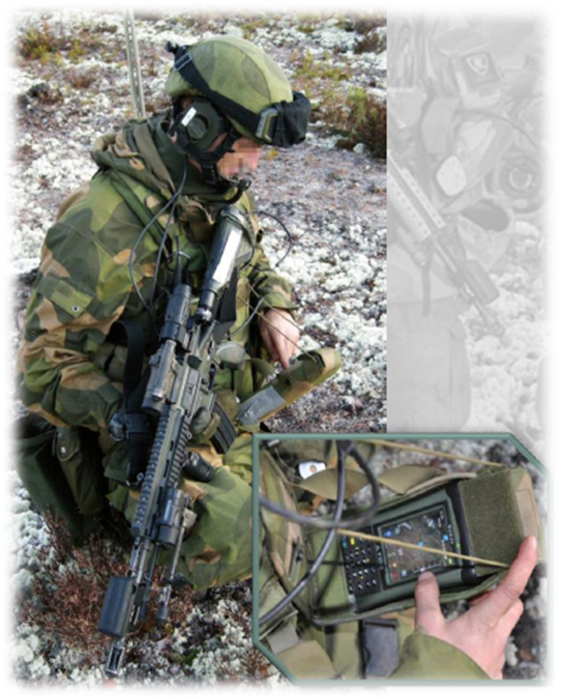
NORMANS gives soldiers superior situational awareness, with blue force tracking, navigation, target hand-off, and text messaging. The system enables soldiers to plan and complete operations with speed, precision and efficiency. The concept consists of: NORMANS Light, designed for the individual team members in a Dismounted Close Combat (DCC) squad, and NORMANS Advanced, tailored to the needs of the DCC squad leader and next in command. The improvement in combat effectiveness and safety are well documented.
NORMANS Light (left) and NORMANS Advanced (right)
NORMANS Light provides filtered situational awareness to all soldiers, keeping the weight and complexity of the system to a minimum, thus multiplying force efficiency and providing force protection.

NORMANS Light weights 150g (without cabling), and is powered directly from the radio, or from a central power unit.

NORMANS Advanced supports squad leaders’ command and control. It provides situational awareness and the secure distribution to subordinate units of orders, timecritical information and up-to-date operational pictures. NORMANS Advanced connects to a NATO C4IS through a national C4I System enabling blue force tracking, command and control and combat air support.

NORMANS Advanced weights 450g (without cabling and battery), and is powered directly from the internal battery. NORMANS Advanced supports a number of commonly used map and messaging formats, as well as IP-based communications.

The Context

The Norwegian Defence Research Establishment (FFI) has led a comprehensive program on forming the future Norwegian soldier solution in close collaboration with operational forces and Norwegian defence industry.

NORMANS has been through a 10 year process of iterative development, where Thales Norway has led the industrialisation of NORMANS digitised soldier system with Teleplan Globe as partner. FFI has documented significant improvement in operational effectiveness and increased safety for the soldier with NORMANS compared to the current solution which is based on paper maps and hand held GPS.

As the Prime contractor, Thales Norway will be responsible for delivering information systems to Norwegian soldiers over a 5 year period

Comments

NORMANS digitised soldier system will provide Norwegian soldiers with improved situational awareness, improved ability to navigate and will provide effective mission planning. As a result of this soldiers will have increased effectiveness and safety in operations”, says Secretary of State in the MoD, Roger Ingebrigtsen.

Soldier modernisation has been a focus area for Thales over the past 10 years. We have had strong collaboration with The Norwegian Defence, the Norwegian Defence Research Establishment and a number of Norwegian industrial players in the process of industrialising the future Norwegian soldier solution. We are proud to be chosen to deliver the NORMANS system, and we are looking forward to continuing the close collaboration with Teleplan Globe and other Norwegian industrial players in order to provide Norwegian soldiers with improved operational effectiveness and safety. NORMANS has already gotten attention internationally and we are also looking forward to offering the system outside of Norway”, says CEO of Thales Norway, Glenn Pedersen

Further Readings
  • NORMANS Digitised Soldier System (pdf)
  • NORMANS Concept (pdf)

October 5, 2011

ITT launches new application for enhancing airspace situation awareness in Alaska


References: ITT (1)

News Report

As announced in a recent press release, ITT has launched a Web-based data visualization application, named AlaskaVue, that enhances the safety and operational efficiency of Alaskan airspace by providing unprecedented fleet awareness.

ITT’s AlaskaVue provides a cost-effective solution for understanding in real time where flight assets are located. This capability is particularly significant for Alaska, where weather, terrain and gaps in radar coverage can affect situational awareness and contribute to accident rates that are much higher than in the continental United States.

The Application

AlaskaVue is based on a synthesis of multiple FAA system-derived aircraft surveillance data available in the U.S. National Airspace System. AlaskaVue data sources include data derived from the U.S. Automatic Dependent Surveillance-Broadcast network (ADS-B) being deployed by ITT, along with Wide Area Multilateration (WAM) data from FAA-deployed WAM systems.
The AlaskaVue application service has pan and zoom capabilities; multiple views, such as satellite, maps, charts and elevation; multiple overlays, such as significant boundaries, runways, air routes and navigation aids; flexible display options; and color coding of flight objects. AlaskaVue includes saved views and historical playback.

Subscribers to AlaskaVue will access the data visualization application and the comprehensive surveillance data via the Internet.
Comments

Alaskan airspace has undergone a dramatic transformation in recent years. It began with the success of the Alaska Capstone Project, which laid the groundwork for implementing the Federal Aviation Administration’s (FAA) Next Generation Air Transportation System (NextGen) initiative,” said John Kefaliotis, ITT’s vice president of next generation transportation systems. “ITT continually looks for ways to support airspace safety and efficiency; the launch of AlaskaVue provides real-time flight tracking and historical playback to improve flight safety in Alaska.

October 4, 2011

QinetiQ provides global asset tracking solutions to Czech Army

References: Jane's (1), QinetiQ (2,3), A-N-T (4), IridiumEverywhere (5)

News Report

As reported by Jane's, the Czech Army is among those now using the Bushman global asset tracking system, an improved blue force tracking system developed by QinetiQ on the back of its experience with the Helicopter Asset Tracking and Ground Asset Tracking Systems previously supplied to the UK Ministry of Defence.

The System

QinetiQ has developed a simple highly effective ‘pay-as-you-go’ satellite-based asset tracking service, which enables to have complete control of all assets at any given time. The service provides truly global coverage, enhancing situational awareness by enabling the user to locate and track their assets 24/7. It is ideally suited to nations seeking to participate in NATO coalition operations, and facilitates sharing of locations between partners.

In general terms, the system consists of small communicators that are attached to the assets, and a hi-tech map-based user interface which gives position reports on-demand. An integrated picture of the tracked assets can be received directly on the bridge or on a handheld device. The QinetiQ system has flexible web-based or satellite-based functionality, and also provides secure feeds into corporate networks, supporting a number of data formats and mapping applications, including Google Earth. Users can decide the extent to which they wish to interact with the system, safe in the knowledge that the Bushman system is equipped with alarm functionality and will send alerts directly to a PC or handheld PDA device, in the event of an emergency.

QinetiQ's Bushman solution consists of 4 different components:
  • Bushman Commander: a command and control and blue force tracking terminal which receives from multiple independent paths to ensure the user is always connected anywhere in the world, supporting rapid changes in coalition operations.
  • Bushman Airborne: a flight-cleared tracking solution for use in the airborne environment, consisting of a modem unit placed remotely in the avionics bay, and a control unit to be integrated directly into the cockpit.
  • Bushman Dismounted: a handheld personal tracking device which can be easily attached to body armour or webbing for the combat fighting soldier, and that can be set into a range of modes including; motion activation, text messaging and immediate emergency alert notification.
  • Bushman Mobile: a vehicle mounted tracker that is capable of operating from either vehicle power or battery and provides user-configurable updates of vehicle locations.
Coupled with the low latency and global reach of Iridium’s constellation of 66 low-Earth orbiting (LEO) satellites, the QinetiQ system is viewed as a cost-effective solution offering unique asset-tracking capabilities. That’s particularly the case for troops operating in Afghanistan’s deep valleys, where mountains disrupt line-of-sight communications systems and often thwart the military’s geostationary satellite communications systems. Iridium’s fast-moving LEO satellites provide full coverage, even in this extremely difficult terrain.

The QinetiQ system is interoperable with a range of Geographic Information System applications and military communications networks. That permits to share information with NATO and coalition forces. It is compatible with the Joint Automated Deep Operation Coordination System (JADOCS). A “go to war” command-and-control tool, JADOCS is designed to improve situational awareness across the military decision-making process. One key use is for deconfliction of weapons systems, such as to keep aircraft from flying through space where artillery operations are being staged. The QinetiQ system also works with Tapestry, a distribution management system used by U.S. forces and security contractors operating in Iraq to manage and track containers and for logistics. In addition, the system is compliant with NATO’s Friendly Force Identification network.

The Context

Since 2005 QinetiQ have provided a secure satellite tracking system to the UK Ministry of Defence that provides worldwide access and reliable service for secure global asset tracking. The system uses the Iridium satellite communications system to provide world wide coverage. The system uses commercial off the shelf (COTS) equipment; protected with military grade encryption and security to provide a secure and robust tracking capability.

Working with Iridium and NAL Research, which supplies the hardware components, QinetiQ developed and fielded the HeATS (Helicopter Tracking System) and GrATS (Ground Asset Tracking System) under an Urgent Operational Requirement from the U.K. Ministry of Defence for improved tracking and monitoring of aircraft and ground vehicles in Afghanistan. Using Iridium’s global short-burst data (SBD) service, the systems have helped to enhance situational awareness, accelerate the tempo of operations, and improve response time to troops needing assistance in the field.